

2025's Top 5 Topographic Surveying Drones in the USA: Precision & Performance
Published on Saturday, April 12, 2025
Topographic surveying drones are essential for capturing elevation data and terrain features, revolutionizing the way professionals approach mapping and land use. In United States, the demand for these advanced aerial tools has surged, driven by industries such as construction, environmental studies, and urban planning. Consumers are increasingly drawn to these drones for their precision, efficiency, and ability to produce real-time data. Whether for a professional surveying firm or an individual enthusiast, topographic surveying drones enable more accurate analyses and streamlined workflows, making them indispensable in the modern landscape analysis toolkit.
Top Picks Summary
DJI Mavic 3 Enterprise
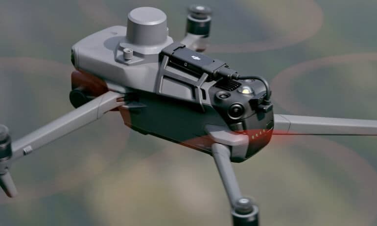
The DJI Mavic 3 Enterprise Advanced stands out with its exceptional imaging capabilities, featuring a dual-camera system that includes a 48MP wide camera and a 12MP telephoto lens. Its advanced features like obstacle sensing in all directions and superb flight time enhance its usability for various industrial applications. This drone is also equipped with RTK capabilities for precise mapping and surveying, making it a leader in its category. Designed for professionals, it strikes the perfect balance between portability and performance.
Where to buy DJI Mavic 3 Enterprise in USA: the trusted retailers we track in this market, with the best price we have observed at each. Prices are checked regularly and can change, and the retailer confirms the final price at checkout.
We may earn a commission on purchases. It never affects our rankings.
$6,599.00USD
Trimble ZX5 Multirotor
The Trimble ZX5 Multirotor is designed for survey-grade accuracy and efficiency in various aerial applications, making it a competitive choice in the UAV market. It boasts a robust flight system combined with cutting-edge sensors, ensuring precise data capture under diverse conditions. With its seamless integration with Trimble software, users can enhance their workflow and data management significantly. Strong in reliability and support networks, it has established itself as a market leader in surveying drones.

Where to buy Trimble ZX5 Multirotor in USA: the trusted retailers we track in this market, with the best price we have observed at each. Prices are checked regularly and can change, and the retailer confirms the final price at checkout.
We may earn a commission on purchases. It never affects our rankings.
$8,000 – $10,000
Parrot Anafi USA
The Parrot Anafi USA is a powerful drone that combines military-grade specifications with user-friendly features, making it ideal for first responders and professional filmmakers. With its unique 32x zoom camera and thermal imaging capabilities, it excels in a variety of applications from search and rescue to cinematography. Its lightweight design allows for extended flight times while maintaining high performance. Additionally, the Anafi USA is built to withstand harsh conditions, underscoring its versatility and robustness in the field.

senseFly eBee Geo
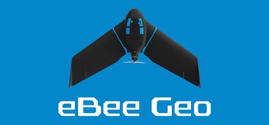
The SenseFly eBee Geo is recognized for its efficiency in surveying, mapping, and modeling, offering unmatched ease of use and integration with GIS software. As a fixed-wing UAV, it provides extended flight range and coverage, making it efficient for large land surveys. Its high-resolution mapping capabilities and diverse payload options set it apart from traditional drones, catering specifically to geospatial professionals. Furthermore, the eBee Geo’s automated flight plans streamline the data collection process, making it a favorite in its category.
Where to buy senseFly eBee Geo in USA: the trusted retailers we track in this market, with the best price we have observed at each. Prices are checked regularly and can change, and the retailer confirms the final price at checkout.
We may earn a commission on purchases. It never affects our rankings.
$20,000 – $25,000
WingtraOne GEN II
The WingtraOne GEN II redefines drone mapping with its vertical takeoff and landing (VTOL) design, combining the portability of multirotors with the efficiency of fixed-wing drones. It is capable of covering large areas in fewer flights while delivering high-resolution imagery and accurate mapping data. With its advanced AI-powered workflow, users can easily process the collected data for various professional applications. This drone's unique design sets it apart, ensuring it meets the demanding needs of surveying and mapping professionals.

Where to buy WingtraOne GEN II in USA: the trusted retailers we track in this market, with the best price we have observed at each. Prices are checked regularly and can change, and the retailer confirms the final price at checkout.
We may earn a commission on purchases. It never affects our rankings.
$15,000 – $20,000
Integration of precise geospatial mapping and elevation data collection technologies enhances accuracy and efficiency.
Understanding Topographic Surveying Drones
Topographic surveying drones are at the forefront of aerial data collection, enhancing precision in land surveys and environmental assessments.
Utilize GPS and advanced sensors to create accurate elevation models, which is crucial for land use planning.
Integrate LiDAR technology to capture detailed 3D mapping data, improving the understanding of terrain features.
Enable real-time data collection, allowing for immediate analysis and decision-making in fast-paced projects.
Lower costs in surveying operations by reducing the need for ground personnel and heavy equipment.
Increase safety by conducting surveys in hazardous areas without putting staff at risk.
Support sustainable practices by helping monitor changes in the environment over time, aiding conservation efforts.
Frequently Asked Questions
Which drone should I pick for topographic mapping fieldwork?
Choose the DJI Mavic 3 Enterprise Advanced if you want survey-ready imaging plus omnidirectional obstacle sensing and long flight time; it has a 4.8 average rating.
Does the DJI Mavic 3 Enterprise Advanced include dual-camera specs?
Yes—DJI Mavic 3 Enterprise Advanced uses a dual-camera system: a 48MP wide camera and a 12MP telephoto lens, with omnidirectional obstacle sensing.
How does Parrot Anafi USA pricing compare for mapping features?
Parrot Anafi USA costs $1297.99 and offers thermal and optical imaging plus a unique 32x zoom camera, with a 4.5 average rating.
Is the Trimble ZX5 Multirotor better for industrial surveying accuracy?
Trimble ZX5 Multirotor is built for survey-grade accuracy and efficiency with precision mapping capabilities; it has an average rating of 4.6.
Conclusion
In summary, topographic surveying drones offer significant benefits to various sectors in the United States, transforming how we map and analyze our environments. We hope you found the information useful, and if you're looking for more specific details, feel free to use the search bar for tailored insights.